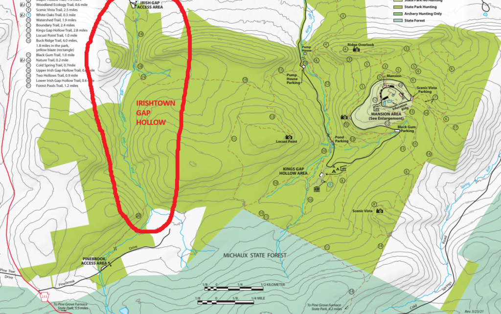
The Irishtown Gap Hollow follows a mountain stream located in the western portion of Kings Gap park. Sometime in the early 1800s, someone built a small settlement consisting of a lumber mill and at least one farm along the stream. While the original mill and farm are visible only by stone remnants today, the settlement grew into a small community that still exists to the north of the hollow. The remains of the original mill and farm can be seen today along the trail between the Irish Gap Access Area to the north and the Pinebrook Access Area to the south. (There is no signage and few trrail markers, so you had best have a good park map handy!)
We are very fortunate that in 1923 a graduate student named Amanda Telep wrote her graduate thesis on Irishtown Gap Hollow. For the first time ever, someone did the necessary fieldwork to piece together information that gives us a much better idea of the people who lived here. She also documented the geology of the region, testing minerals and soil samples. She and her team collected metal and ceramic artifacts and also documented the industrial activity of the region, including the timber used for creating charcoal, which was used in nearby Pine Grove Furnace for iron smelting. She provided description and photographs of the collier huts used by workers who camped for long periods in the woods to make charcoal. She also documented the area as a stopover on the Underground Railroad between Shippensburg and Harrisburg stations. All in all, Amanda’s thesis offers a rare glimpse into early life in the Cumberland Valley. Click link below to access the report. And don’t forget to leave a comment if you enjoyed her work.
Link to Amanda Telep’s graduate thesis on Irishtown Gap Hollow
Q&A with Amanda Telep regarding her Irishtown Gap research
What are your goals for the Irish Gap study and area?
My main goal was to complete my master’s thesis, which included the archaeological survey, background research, and the final thesis paper. As part of the ongoing research, my hope is that my work will generate additional research questions for future archaeologists or historians who are interested in Irish Gap and the broader regional history. I believe there is much more to discover regarding localized history, and I see my survey work as only a small piece of what may eventually be uncovered.
Is this project finished? What lies ahead?
Within the hollow, there are additional rock features that could be examined. Unfortunately, I was limited by time and could not test all of the rock piles and walls present in the area. In the future, more excavation could be conducted to investigate their use and purpose and to learn more about land use and occupation within the hollow. Additionally, soil probing could be undertaken at the dam to verify the presence of the pooling dam and determine how large the pool may have been to the east of it. As part of ongoing research stemming from my project, interpretive signage could be added along the trail to discuss historic land use in the hollow and better connect the public with local history.
Has the state taken an interest in making an example out of it?
I have not been made aware of any direct interest from the state in the project. However, as a result of the archaeological survey, the two sites investigated within the hollow received official state site numbers through the Pennsylvania State Historic Preservation Office (SHPO). The recordation of these sites provides an official entry in the state database, meaning any future work within the hollow by the park will need to consider potential impacts to these sites.
Are you afraid artifact hunters may damage the site?
Since these sites are located along a public trail, there is a risk of looting. This underscores the importance of public signage. Not only is removing artifacts from the archaeological record unethical, it is also illegal on public lands. Signage can provide information about the sites while also explaining the consequences of removing artifacts or damaging archaeological features. Once artifacts are removed or features are disturbed, the information they contain is lost forever. Artifacts provide insight into time periods, human activity, socioeconomic status, and much more. Removing an artifact robs the collective archaeological record, which belongs to humanity as a whole.
Is there anything unique about Irish Gap, or is it representative of the time?
I think the South Mountain landscape is quite unique, and Irish Gap, having remained largely undisturbed by commercialization, offers a window into that distinctive landscape of the eighteenth and nineteenth centuries.
Was this a “wild country,” or were residents tethered to nearby civilization?
I have thought about this question quite a bit and find it difficult to define what would have been considered “populated” versus “wild” in the eighteenth and nineteenth centuries. This region experienced fluctuations in population due to changing land use. During the height of the charcoal iron industry, the rolling hills were heavily timbered, and charcoal hearths littered the landscape. The presence of a sawmill in the mid-nineteenth century suggests a working, timber-focused landscape. Residents were likely fairly self-sufficient but still needed to make occasional supply trips to nearby towns.
What was the peak population?
This remains unknown.
What date was the first census?
Why did the Irish Gap road fall into complete disuse?
Over time, other roadways were constructed that provided more efficient routes to and from the area. As a result, the Irish Gap Road likely fell out of use and was gradually reclaimed by the forest, eventually becoming impassable except on foot and largely forgotten.
How many helpers did you have, and would you have liked to do more pedestrian surveys?
I had many helpers throughout my project. Three individuals assisted during the excavation phase, and two others helped with the pedestrian survey. I think a broader pedestrian survey would have been beneficial, as there are additional rock features I was unable to investigate. With more time and personnel, I could have examined more areas, but I was limited by the timeframe of the project.
Are you disappointed by the low number of above-ground features?
I was not disappointed, as I did not conduct extensive excavation. I completed only one test unit and shovel testing at the two sites. Had I conducted more test-unit excavations, I might have identified additional features. However, I would not attribute the lack of features to socioeconomic status. Instead, it likely reflects the nature of the sites, environmental conditions, and the limited extent of subsurface excavation.
How would you describe the people of Irish Gap Hollow?
I imagine these individuals were highly resourceful and had strong family or community ties, as they relied on one another for survival. I picture them as resilient people who knew the land well and were not averse to hard work.
Was anything of monetary value discovered?
I did not find anything that would typically be considered monetarily valuable, such as coins or weapons. I recovered nails, ceramics, and other historic artifacts that most people would not view as valuable in a monetary sense. Archaeologically, however, the sites hold significant data potential and are therefore very valuable for understanding the region’s history.
Were you surprised by how hard the work was? What was your biggest challenge?
The most difficult part of the study was accessing the site. The hike in and out was strenuous, especially while carrying equipment. Coordinating travel from my university and transporting students was also challenging, as the drive was roughly three hours. I am very grateful to those who were willing to travel such a long distance to assist with excavation.
Was land ownership taking place in this settlement?
Land records are unclear regarding how John Keller came to own the land where the sawmill was located. This may be due to the loss of land records prior to the mid-nineteenth century. While it is difficult to determine exactly who occupied the hollow, we do know that occupation occurred during the period when the Keller family owned parcels in the area.
How would you rate your experience with the technical tools used?
These tools were essential for accurate site documentation. The Nikon Total Station was critical for capturing plan-view data and understanding site layout. ArcMap was also necessary, as it provided an effective and intuitive way to present and analyze spatial data.
Is there a way AI could be used to analyze your data?
There are many ways AI could assist in data interpretation. AI can analyze artifact assemblages using statistical methods to identify broad patterns that help archaeologists better interpret sites. It is particularly effective for analyzing large datasets. While I did not use AI during my project, I have since found it to be a useful tool.
Did you identify any collier hut foundations?
I did not identify any collier huts during this survey, though I suspect some may exist nearby. After charcoal production ended, these features were likely left behind and may have been used as temporary shelter by Underground Railroad freedom seekers. I hope future research—archaeological or otherwise—will explore this possibility further.
Was Irish Gap primarily a sawmill rather than a charcoal settlement?
I did not identify any charcoal hearths or collier huts within the immediate vicinity of the Domestic Site or the Jacob Keller Sawmill site. That said, their absence does not rule out charcoal-related activity nearby. Based on my survey results, the primary land use appears to have been timbering and timber processing at the sawmill.